Zoning
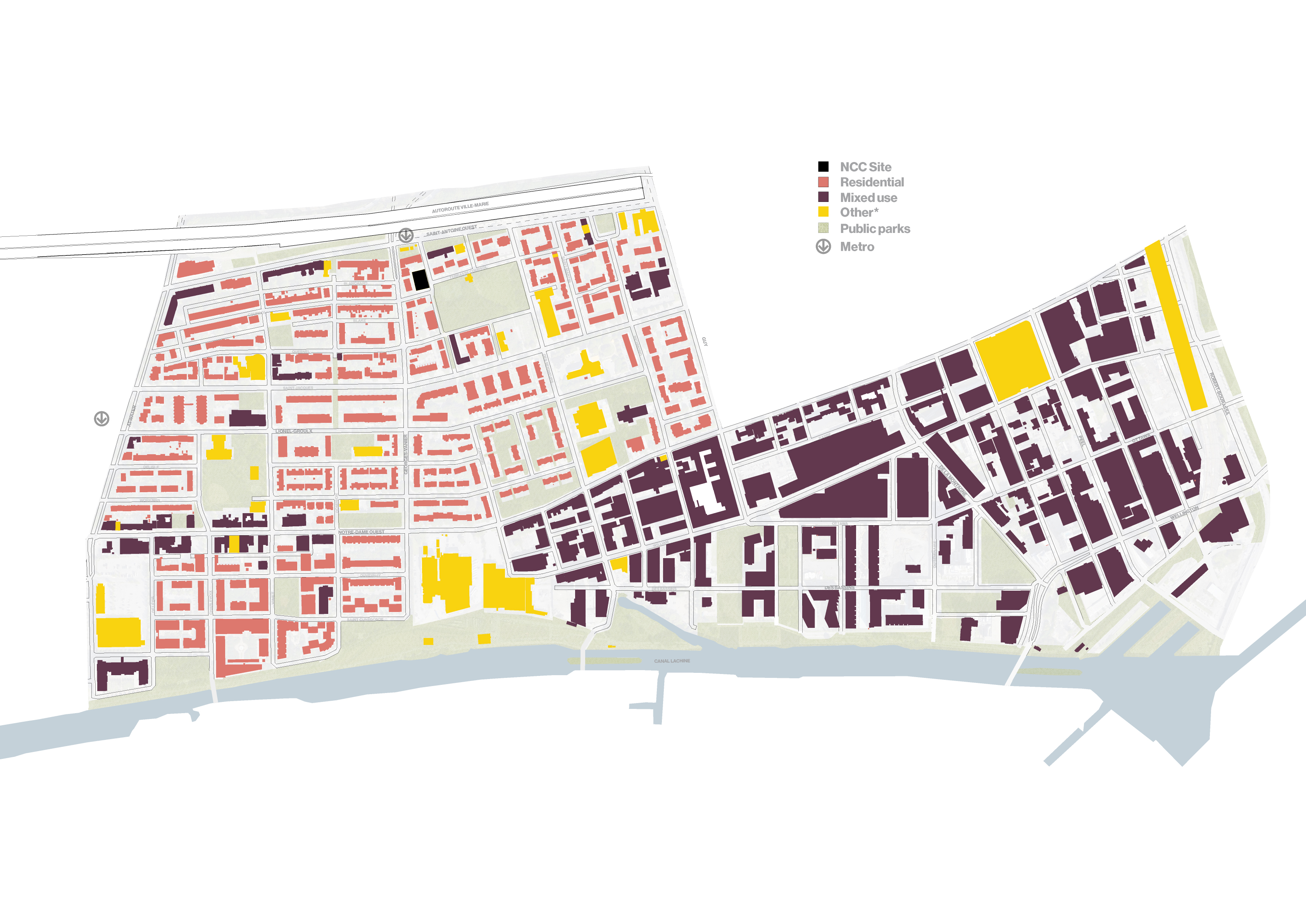
In the figure below, the zoning of Little Burgundy is defined by two main areas: residential and mixed-use. The Others category is added, combining satellite cultural, sports and transit spaces plus strictly commercial buildings. The latter spaces occupy a relatively small area on the territory, but they together form a important socio-physical category in the neighbourhood.
 The zoning diagram displays the disparity and clear separation of usages within the fabric.
Among this concentration, few shops, restaurants or business centers are available to residents except the community organizations that populate the neighbourhood. To go-out or get groceries, the residents of Little Burgundy need to travel to the mixed-use areas on Notre-Dame Ouest towards Griffintown, or along the Notre-Dame Ouest and Atwater arteries. With an increasing density, now equivalent to Plateau Mont-Royal, and the construction of condos in Griffintown, the neighbourhood lacks amenities within proximity. The clear separation of use complicates access to essential services by active transportation, and more so impacts the most vulnerable people. Having community landmarks within the fabric facilitates the access to some of those needs.
Although, the goal of mixed-use is to primarily occupy the street-level with shops, offices or any other non-residential space, the outcome differs and reveals domestic space at street level in the newest constructions, making certain spaces less animated by the public.
Although, the goal of mixed-use is to primarily occupy the street-level with shops, offices or any other non-residential space, the outcome differs and reveals domestic space at street level in the newest constructions, making certain spaces less animated by the public.